


National Park Service
4.91.76K Reviews
App Specs
- Version
- 2.12.0
- Updated On
- License
- Free
- Downloads
- 1,000,000+
- Developer
- National Park Service
- Categories
- Travel & Local
- Platform
- Android, iOS
Screenshots
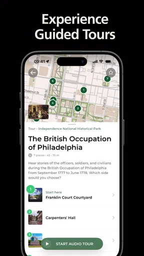

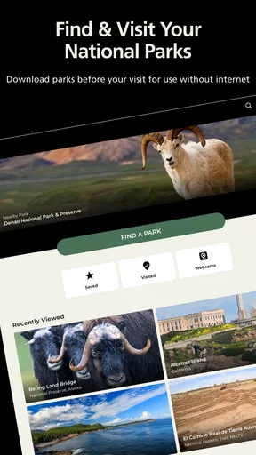
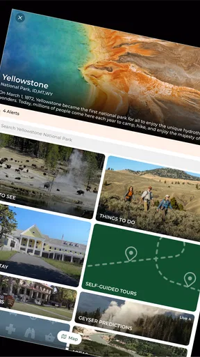
 Analysis by AppCompare
I judge a park app less by how polished it looks at home and more by whether it helps me make sensible decisions when plans are changing. That is the lens I bring to the National Park Service: it is a free travel and local app from the National Park Service, aimed at people who want park-specific information alongside their trip planning. I would treat it as a useful companion, not as a substitute for preparation or sound judgment outdoors.
Quick checks before the trip
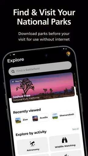
When I’m planning a visit, the first useful habit is to look up the particular park rather than assume every destination offers the same things. The app covers more than 420 parks, but the information that matters to a day out—activities, events, conditions, and places to visit—will naturally depend on where you are going. I’d use it to sketch a plan, then keep that plan flexible instead of treating a screen as a promise that a trail or facility will be available.
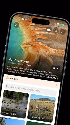
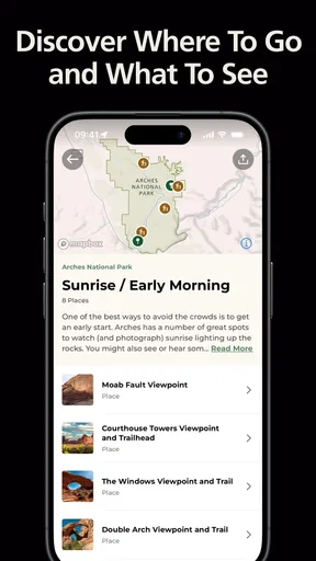
For a short visit, I’d start with the map and the “Things to Do” area, then check for events or ranger programs that fit the time I have. That order helps me avoid building a whole day around one activity before I know what else is nearby. If I’m travelling with someone who prefers a gentle walk or a historic stop to a longer hike, browsing activities together can make the plan more realistic than simply following the most obvious route.
When the day gets busy
The moments when I expect an app like this to earn its place are the small decisions that pile up: which area to visit first, whether a scheduled program fits between stops, and what to change when conditions shift. A park-specific alert can matter more than a broad search result because it gives me a reason to reconsider the plan before I set off. I would still read the details carefully and use posted signs and staff guidance on site; a phone update is helpful context, not permission to ignore what I see around me.
Here’s a realistic use case: I’m visiting for only part of a day, and a companion wants a ranger-led activity while I’m also hoping to see a viewpoint. I’d check event timing first, identify the relevant places on the map, and leave room for the walk between them rather than packing the schedule edge to edge. If the program does not fit, the activity listings give me another way to choose what to do without starting the search from scratch.
Offline planning and sensible limits
Downloading a map before leaving reliable service is one of the most practical habits described for this app. I’d do it while connected, check that the area I care about is available for offline use, and open it before heading out. That last check matters: “I downloaded it” is not the same as confirming that the map I need is ready when reception disappears. I would also keep a separate navigation or safety plan for demanding outings, since an offline map should not be mistaken for a complete substitute for preparation.
This is where the app’s scope has a trade-off. Bringing information for a very large collection of parks into one place is convenient, but it does not make every screen equally relevant to every visit. I would focus on the destination I’m actually visiting and avoid expecting one generic workflow to cover local conditions, personal route planning, and every practical need. For remote travel, I’d save the important details before departure and carry whatever backup information makes sense for the outing.
Worth Reading Before You Choose

EA SPORTS FC Mobile 26 Is a Bigger Football Game, but It Takes Time

Flipboard Shows What News Apps Must Do Beyond the Feed

Switching to Android Auto Means Rethinking Your Driving Routine

Google Calendar Makes a Crowded Week Easier to Manage

Ludo King Makes the Most of the Minutes Between Plans

Baby Panda World Brings Quick Play to Modern Phones, but Its Game Library Feels Busy
Who will get the most from it
I think the app is most useful for people who visit parks occasionally and want an official starting point for planning, as well as regular visitors who like checking activities and program details before setting out. It can also help groups with mixed interests agree on a day plan: one person can look for walks, another can browse historical or ranger-led options, and everyone can compare choices before arriving.
If your main need is turn-by-turn driving directions, a dedicated navigation app may be the better tool for that task. If you want broad user reviews, photos, or recommendations across restaurants and attractions outside park boundaries, a general travel service may suit you better. I’d use those tools alongside this app when needed, rather than expect the National Park Service app to replace them. Its value is the park-focused perspective, not being an all-purpose travel planner.
The app is free and rated for Everyone, which makes it easy to recommend for family trip planning. The National Park Service developed it, and its 4.9 average from around 29,000 ratings reflects strong user approval. I also see a practical reason for that interest: it brings park information and planning choices together without asking visitors to begin with a patchwork of unrelated searches.
First Impressions: A Walk in the Park
So, I downloaded the National Park Service app with high hopes, and let me tell you, it didn’t disappoint. The interface is clean and intuitive, making it super easy to navigate. Right from the get-go, it feels like a well-organized guidebook with a modern twist. You've got your main menu options laid out neatly, giving you access to parks, events, and more without any fuss.
The app is available on both Android and iOS, which is a plus because everyone gets to join in on the fun. The download was quick, and it didn’t take up much space on my phone, which is always a bonus.
Features: More Than Just a Map
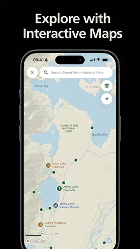
Once you’re in, the app opens up a world of possibilities. One of my favorite features is the interactive maps. These maps are not just your basic topographical guides; they’re loaded with trails, visitor centers, and even live updates on park alerts. If there's a road closure or a bear sighting, you’ll know about it first.
Another feature that stands out is the "Things to Do" section. It’s like having a personal itinerary planner. You can check out activities from hiking trails to historical tours, all tailored to your interests and the park you’re visiting.
The app also includes a section for events and ranger programs. If you’re looking to join a guided hike or attend a park festival, the app’s got you covered with dates, times, and locations.
User Experience: Smooth Sailing
Using the app is a breeze. Everything loads quickly, and the information is laid out in a way that’s easy to digest. The search function works like a charm, helping you find exactly what you need without any hassle. Even if you’re not tech-savvy, you’ll find this app very user-friendly.
For a fair performance judgment, I’d separate everyday browsing from use in a remote area. On a normal connection, the experience feels straightforward: I can move between park information and planning details without wrestling with a complicated interface. In the field, though, speed depends on more than the app. A weak signal can slow down anything that needs fresh information, so I would not wait until I’m at a trailhead to look up plans or alerts.
On an older or more constrained phone, I would keep expectations practical. The app’s current version is 2.9.3, and it supports Android 7.0 and up. Those compatibility details make it worth checking the device before a trip, especially if the phone is an older backup handset. I would also leave enough battery for photos, calls, and navigation; a park guide is useful, but it is not the only thing a phone may need to do outdoors.
One neat feature is the offline maps. If you’re heading into a remote area with spotty internet service, you can download maps in advance. This is a lifesaver when you’re deep in the wilderness with no signal.
I’d make offline preparation part of the night-before routine: choose the destination, download what I need while connected, and inspect the map before leaving. That catches a basic but easy-to-miss problem—having the app installed while the relevant area has not been prepared for offline use. It also helps distinguish map access from live updates: a saved map can support orientation, while fresh conditions still need a connection to update.
Reliability when plans change
Park days rarely follow a perfect timetable, so I value having several kinds of information in one place. A map can help me understand where a visitor center sits relative to a trail, while an event listing can tell me whether a program is worth building around. When something changes, I can return to the park’s details and reconsider rather than relying only on a note I made days earlier.
That said, no app can guarantee that every piece of information will remain current at the exact moment I need it. I’d use alerts as prompts to check the situation, not as a reason to disregard signs, barriers, staff instructions, or changing weather. For a challenging outing, I would plan with extra care and avoid making safety decisions from a single screen. The app is best as one reliable planning source within a broader, sensible approach.
Why It's a Keeper
What really makes this app stand out is its comprehensive nature. It’s not just about navigation; it’s about enhancing your entire park experience. From discovering hidden gems to ensuring you’re prepared for the weather, it’s like having a ranger by your side.
Speaking of weather, the app provides up-to-date forecasts for your chosen park. You’ll know exactly whether you need that extra layer or if it’s safe to leave the raincoat at home.
My practical performance verdict is that I’d rather have this installed before a park visit than begin searching from scratch when I arrive. Its focused information and offline-map option are useful strengths, while dependence on a connection for fresh details and the need to prepare maps ahead are real constraints. I would not judge it as a replacement for a dedicated navigation tool, but as a park-specific guide it has a clear role. With more than a million installs and a 4.9 average, it is clearly finding an audience among visitors who want that kind of focused help.
Final Thoughts: Nature's Best Companion
In a nutshell, the National Park Service app is a must-download for any nature lover. It’s packed with features that make exploring our national parks easier and more enjoyable. Whether you’re planning a weekend getaway or a long vacation in the wild, this app will be your best friend.
I’d recommend it most to people who want a single park-focused place to begin planning, especially if they expect to use maps, browse activities, or check for ranger programs. If I were going somewhere remote, I’d prepare before leaving service and keep a backup plan; if I only needed road directions or broad destination reviews, I’d pair it with a tool built for those jobs. That distinction keeps expectations realistic and lets the app do what it does best.
So, grab your backpack, lace up those hiking boots, and let the app guide you to the most unforgettable outdoor adventures. Happy exploring!
Pros
- Comprehensive park information.
- User-friendly interface.
- Offline maps available.
- Frequent updates with new info.
- Covers all national parks.
Cons
- Limited interactive features.
- Occasional app crashes.
- No real-time alerts.
- Some parks have outdated info.
- Requires a stable internet connection.
FAQs for National Park Service
What features does the National Park Service app offer?
The National Park Service app provides comprehensive features including interactive maps, self-guided tours, and up-to-date information on park facilities and activities. Users can also access offline maps, receive notifications about park alerts, and explore educational content about the flora, fauna, and history of each park.
Is the National Park Service app available for both Android and iOS?
Yes, the National Park Service app is available for both Android and iOS devices. Users can download it from the Google Play Store for Android devices and the Apple App Store for iOS devices, making it accessible to a broad audience of national park enthusiasts.
Does the app work offline?
The National Park Service app offers offline functionality, allowing users to download maps and key information for use without an internet connection. This feature is particularly useful in remote areas where mobile data may be unavailable, ensuring visitors always have access to crucial park information.
Are there any costs associated with using the National Park Service app?
The National Park Service app is free to download and use. While the app itself does not charge for its features, users should be aware that standard data usage rates apply when downloading content or using the app online. Park entry fees may still apply where applicable.
How frequently is the app updated with new information?
The National Park Service app is regularly updated to provide the most current information on park conditions, events, and alerts. Updates are managed by park staff to ensure accuracy, with seasonal changes and special events typically prompting new app content.


